Animation Gallery
December 2016 — This page has not been updated in a very long time. A new animation gallery is in the works. For now, please refer to recent animations posted on the Climate Reanalyzer Facebook page.
Modern Seasonal Cycle
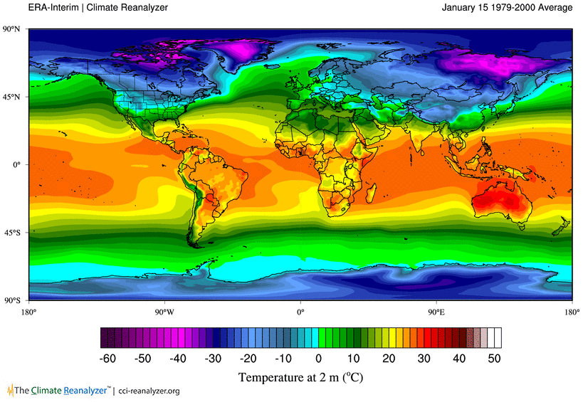
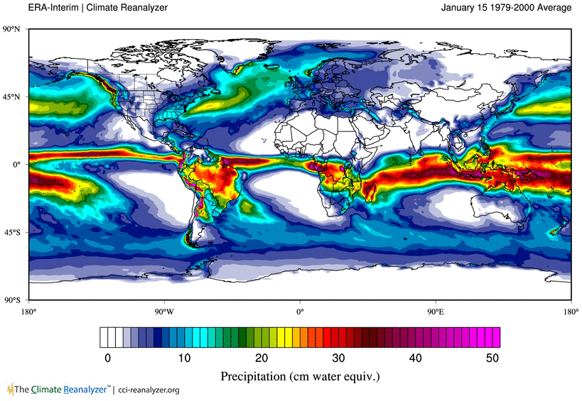
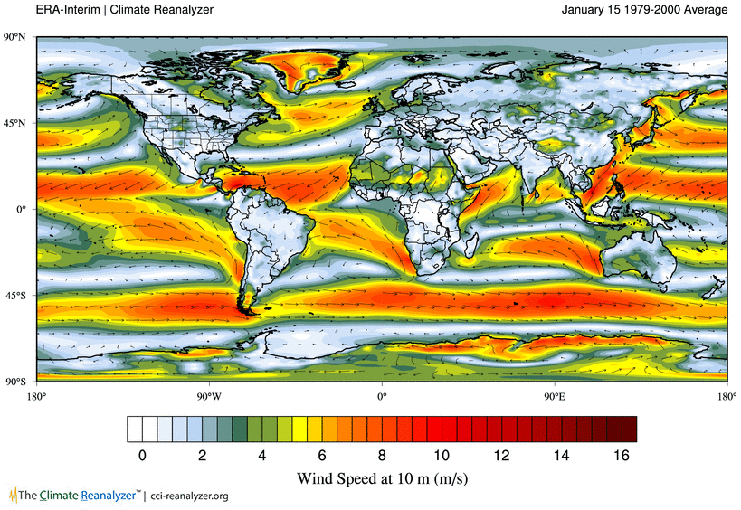
Animations within this group depict the modern seasonal cycle of common
meteorological parameters as derived from monthly ERA-Interim reanalysis.
Each frame represents an average of values from 1979-2000, thus providing
a climatological signal.
Temperature
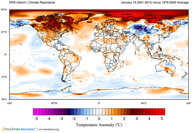
Temperature Anomaly
2001-2012 - 1979-2000
2001-2012 - 1979-2000
Precipitation
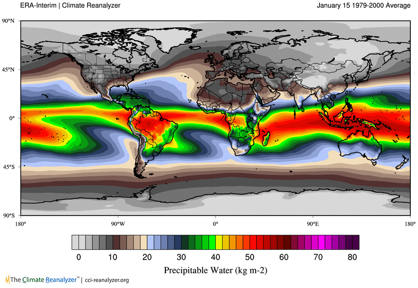
Precipitable Water
Surface Wind
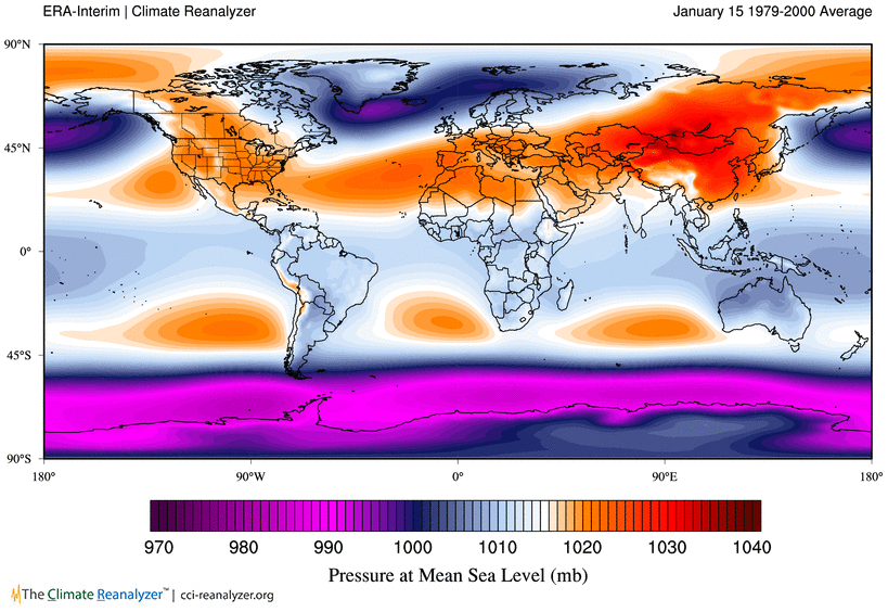
Mean Sea Level Pressure
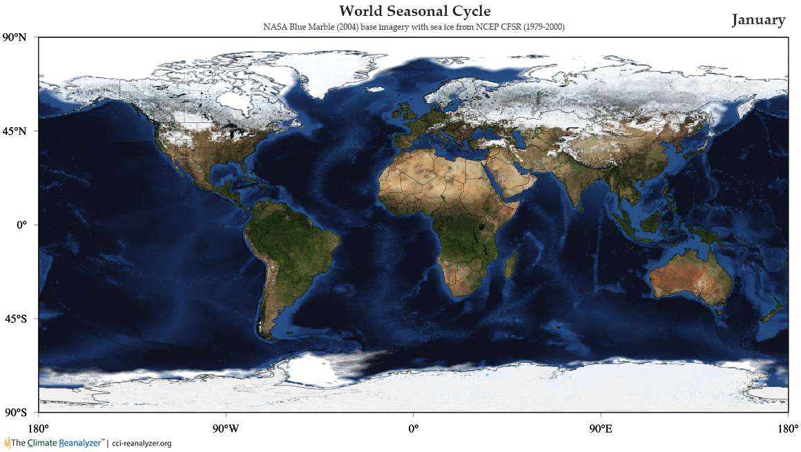
Snow/Ice/Vegetation Seasonal Cycle
These animations depict the modern seasonal cycle of snow, ice,
and vegetation. The animations are made from NASA Blue Marble satellite
imagery (monthly composites captured during 2004) with 1979-2000 sea-ice
climatology from NCEP CFSR overlain.
World
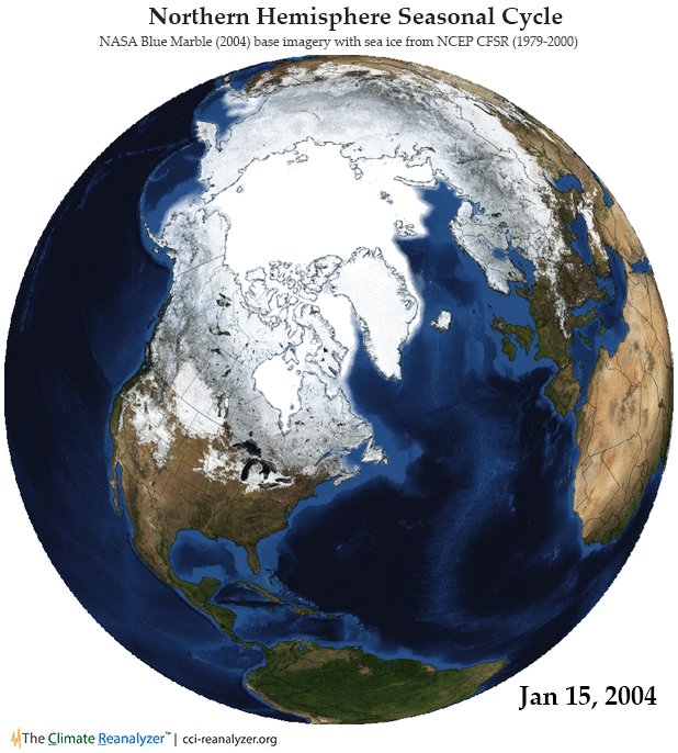
Northern Hemisphere
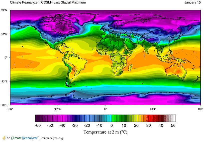
Last Glacial Maximum Seasonal Cycle
These animations depict the temperature and precipitation seasonal cycle of
the Last Glacial Maximum (ca. 21,000 years ago), as calculated from
the Community Climate System Model version 4 (CCSM4) (see
publication). Each frame is a 50-year average.
Temperature

Precipitation
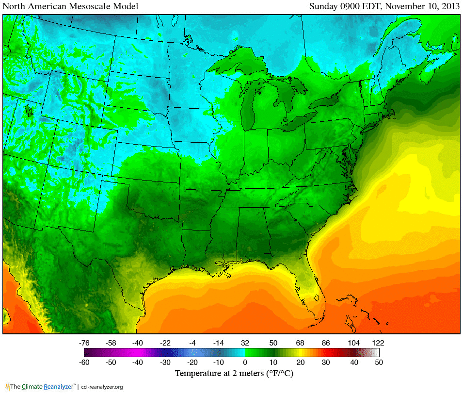
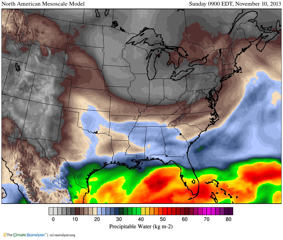
Weather — Cold Front
Below are 48-hour forecast animations (temperature, precipitable water,
precipitation and clouds, and wind) from the North American Mesoscale
Model (NAM) depicting a large airmass descending from northwestern Canada
across central and eastern U.S. The boundary of the airmass is delineated
by an impressive cold front with a broad arc of clouds, snow, rain, and
wind. The forecast was valid on Sunday, November 10th, 2013.
Temperature
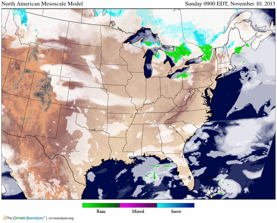
Precipitation and Clouds
Precipitable Water

Surface Wind